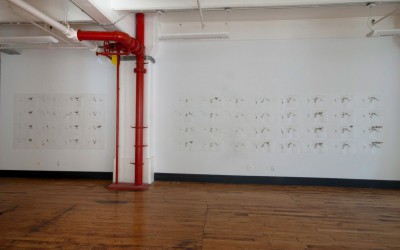
“111 Years” comprises of 111 drawings that map a century of war, from 1900 to 2010.
Methodology:
- A war must have more than 1000 victims to be represented.
- A country’s territory is filled when the war takes place on its soil.
- A country’s border is highlighted when the country sends troops elsewhere to wage war and more than 1000 are lost.
- In the case of a colonial war only the countries directly involved are drawn, per the rules above, and the “Head” of the Empire’s border is highlighted (not the whole empire).
Each drawing is 61 cm x 48 cm, the dimensions of the whole installation are variable.